


Cascadian Voting District, Snohomish County, Washington
About
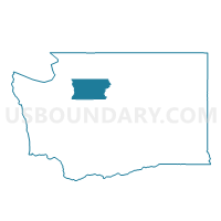
Outline

Summary
| Unique Area Identifier | 688569 |
| Name | Cascadian Voting District |
| County | Snohomish County |
| State | Washington |
| Area (square miles) | 0.27 |
| Land Area (square miles) | 0.27 |
| Water Area (square miles) | 0.00 |
| % of Land Area | 100.00 |
| % of Water Area | 0.00 |
| Latitude of the Internal Point | 47.85294110 |
| Longtitude of the Internal Point | -122.23469690 |
Maps


Graphs
Select a template below for downloading or customizing gragh for Cascadian Voting District, Snohomish County, Washington


Neighbors
Neighoring Voting District (by Name) Neighboring Voting District on the Map
- East Shore Voting District, Snohomish County, WA
- Evergreen Voting District, Snohomish County, WA
- Forest Voting District, Snohomish County, WA
- Martha Lake Voting District, Snohomish County, WA
- Mill Creek 14 Voting District, Snohomish County, WA
- Northroad Voting District, Snohomish County, WA
- Rhody Ridge Voting District, Snohomish County, WA
- Terrace Voting District, Snohomish County, WA
Top 10 Neighboring County Subdivision (by Population) Neighboring County Subdivision on the Map
Top 10 Neighboring Place (by Population) Neighboring Place on the Map
Top 10 Neighboring Unified School District (by Population) Neighboring Unified School District on the Map
Top 10 Neighboring State Legislative District Lower Chamber (by Population) Neighboring State Legislative District Lower Chamber on the Map
Top 10 Neighboring State Legislative District Upper Chamber (by Population) Neighboring State Legislative District Upper Chamber on the Map
Top 10 Neighboring 111th Congressional District (by Population) Neighboring 111th Congressional District on the Map
Top 10 Neighboring Census Tract (by Population) Neighboring Census Tract on the Map
- Census Tract 417.03, Snohomish County, WA (5,039)
- Census Tract 417.04, Snohomish County, WA (5,024)
- Census Tract 519.28, Snohomish County, WA (4,783)
- Census Tract 519.27, Snohomish County, WA (4,714)